The Confederated Salish and Kootenai Tribes
“Our lands and resources are the basis of our spiritual life. That’s been our way since time began. By preparing for further environmental changes, we can mitigate threats to our way of life. Our traditions rely on abundant populations of native fish, and wildlife, healthy plant communities, clear air, water, undisturbed spiritual sites, prehistoric and historic campsites, dwellings, burial grounds, and other cultural sites because these areas reaffirm the presence of our ancestors.“
—Joe Durglo, Chairman Confederated Salish and Kootenai Tribes, Climate Change Strategic Plan for the Confederated Salish and Kootenai Tribes of the Flathead Reservation.
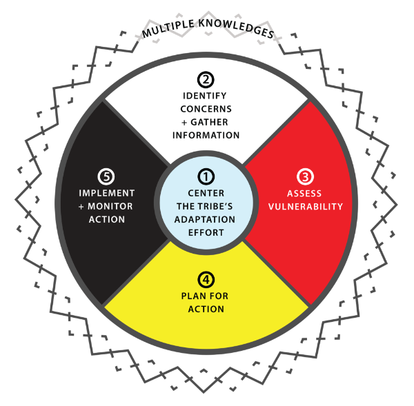
The Confederated Salish and Kootenai Tribes completed a climate change vulnerability assessment[4] following the framework of the Institute for Tribal Environmental Professionals (ITEP) and using a combination of existing climate change projections, Traditional Knowledges, and technical Tribal staff input.
Climate Exposure: Information for this element of the analysis was gathered from a combination of regional projections from the 2009 National Climate Assessment, Global Climate Change Impacts in the United States, and the 2011 Missoula County Climate Action: Creating a Resilient and Sustainable Community report.
Vulnerability Assessment: The vulnerability assessment was completed by Tribal departments and local organizations following ITEP’s guidance and used a vulnerability matrix. Input from these participants helped qualitatively determine the sensitivity, adaptive capacity, and relative vulnerability of the different sectors identified in the plan. Short explanations of why a specific ranking level was selected are included in the summaries provided by the plan.
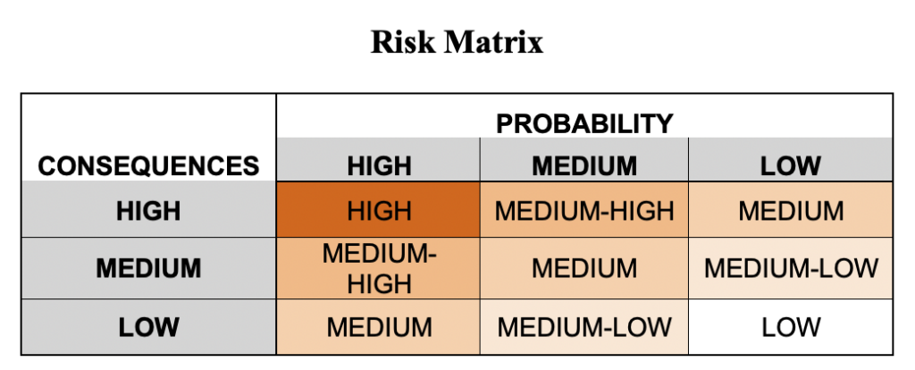
Risk Analysis: A risk analysis was included as a follow up to the vulnerability assessment (Figure 5) in which the participants estimated the probability and magnitude of climate change impacts on the different focus sectors.
Selecting Planning Areas: The Tribes used the ITEP matrix for selecting priority planning areas by combining the identified vulnerability and risk within each of the focus sectors.